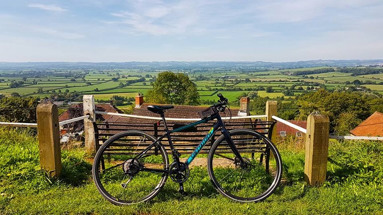
As you may know, I’m cycling The Trafalgar Way in October to raise money for the Duke of Edinburgh’s Award, as part of the D of E Challenge – find out more here.I’ve had so many people ask what The Trafalgar Way is, and if I’m joining the official ride (their website is here if you’re interested) and so I thought I would write a post about all about the following…
1. Why I’m cycling this route.
2. What made me decide to complete this crazy challenge.
3. How I’ve mapped the route and my plans along the way.

What is The Trafalgar Way?
The Trafalgar Way is the route that was used to carry the dispatches with news of victory at the Battle of Trafalgar from Pendennis Point, Falmouth to the Admiralty in London.Lieutenant Lapenotière of HMS Pickle reached Falmouth on November the 4th. He rode the 271 miles “express in a post chaise and four” taking 37 hours and costing £46. He changed horses 21 times along the way and his account of expenses (saved in the Admiralty records) shows where he changed horse and how much it cost at each stop. The route he took was the main Falmouth to London coach road and so each segment was between 10 and 15 miles.
In 2005, this journey was commemorated and plaques were posted along the route at key locations, giving details of the journey and of people in the area who fought with Nelson at the Battle of Trafalgar.

Why are you cycling it?
In 2005, as a Sea Cadet in Somerset & Dorset District I was invited along to the commemorative unveilings of some of these plaques. There was an actor playing Lt Lapenotière, dressed in full naval uniform of the period, and we were all a bit in love with him, as teenage girls are. We paraded in a number of locations throughout our district as part of the celebrations and as I grew older I decided that one day I would walk it, before swiftly realising it would take quite a while and use a lot of my annual leave!And so, after heading to the DofE Gold Awards at Buckingham Palace in May, I decided to sign up for the DofE Challenge and cycle the route instead, as it would be faster!
(Note use of the word faster, and not fast. I am not a fast cyclist!)

How did you map the route?
As I mentioned above, there is an official Trafalgar Way Sportive Ride, though it does not follow the exact route taken by Lapenotière and diverts off towards Abbotsbury.It’s also a longer ride, and me being me (Little Miss Naval History) wanted to cycle the exact route, photographing each of the plaques as I go.
I used the Ordnance Survey Trafalgar Way Map, produced to commemorate the 200th anniversary of the Battle of Trafalgar, showing the old coaching routes and then mapped this (painstakingly) on to OS Maps so that when the time comes I have my route printed out perfectly.

So what is the route?
From Falmouth, it passes through Penryn, Truro, Fraddon, Bodmin, Launceston, Lifton, Bridestowe, Okehampton, Sticklepath, Crockernwell, Tedburn St Mary, Nadderwater, Exeter, Clyst Honiton, Honiton, Wilmington, Kilmington, Axminster, Bridport, Dorchester, Blandford Forum, Woodyates, Salisbury, Andover, Overton, Basingstoke, Hartfordbridge, Camberley, Bagshot, Egham, Staines, Hounslow, Hammersmith, Kensington and finishes at the Admiralty on Whitehall in London.Though, as it’s Trafalgar Day when I finish, I’ll then cycle the last 50m or so to Trafalgar Square.If you want to cycle this too, then email me and I’ll send over the .gpx file 🙂
Donate
If you’d like to donate any money to the Duke of Edinburgh’s Award, then please click the link below.It is a charity, and it really does help so many young people build their confidence, learn new skills and find a sense of adventure!